


Voting District 10220, Kern County, California
About
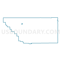
Outline

Summary
| Unique Area Identifier | 531701 |
| Name | Voting District 10220 |
| County | Kern County |
| State | California |
| Area (square miles) | 2.98 |
| Land Area (square miles) | 2.98 |
| Water Area (square miles) | 0.00 |
| % of Land Area | 100.00 |
| % of Water Area | 0.00 |
| Latitude of the Internal Point | 35.55558100 |
| Longtitude of the Internal Point | -119.30987060 |
Maps


Graphs
Select a template below for downloading or customizing gragh for Voting District 10220, Kern County, California


Neighbors
Neighoring Voting District (by Name) Neighboring Voting District on the Map
- Voting District 10110, Kern County, CA
- Voting District 10120, Kern County, CA
- Voting District 10225, Kern County, CA
- Voting District 40585, Kern County, CA
- Voting District 40600, Kern County, CA
Top 10 Neighboring County Subdivision (by Population) Neighboring County Subdivision on the Map
Top 10 Neighboring Elementary School District (by Population) Neighboring Elementary School District on the Map
- Wasco Union Elementary School District, CA (26,302)
- Richland-Lerdo Union Elementary School District, CA (19,085)